Your seasonal context
Understand the place before the date.
How local is this information?
- Postal precision
- Estimated postal coordinates · limited location precision
- Climate reference
- ECCC · 1991–2020 · 8.2 km from the postal reference point
- Planting dates
- General crop stages · choose a locally advised date
- Source review
- September 28, 2026 · source data period is separate
Distance alone does not establish a climate match. Elevation, coastal exposure, urban shelter and soil can differ; the postal location has no verified garden elevation.
Your postal reference & climate station
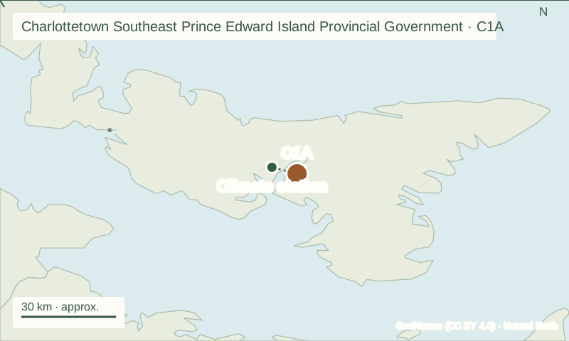
The postal reference point is near 46.272°, -63.017°. At the nearest qualifying ECCC station reference (CHARLOTTETOWN (AIRPORT)), July is the warmest month on average (19.0°C), while January is the coolest (-7.3°C). This does not measure your garden’s temperature.
Reference monthly means are below freezing in January, February, March, December. This signals a need to assess protected growing, not a calculated planting prohibition. Check local crop advice alongside this seasonal context. A monthly average cannot identify a safe planting day.
Light at your latitude
At 46.272° N, the length of the day changes independently of temperature. Compare the middle of three seasons when planning your garden.
Geometric daylight estimate from latitude and solar declination, rounded to 0.1 hour. This is time above a flat horizon, excluding atmospheric refraction, hills, buildings and cloud cover. It is not the direct-sun exposure of your bed. About solar-position calculations.
| Month | Mean air temperature | Monthly precipitation total |
|---|---|---|
| January | -7.3°C (19°F) | 101.4 mm |
| February | -7.3°C (19°F) | 85.4 mm |
| March | -2.6°C (27°F) | 83.9 mm |
| April | 3.0°C (37°F) | 74.8 mm |
| May | 9.1°C (48°F) | 78.3 mm |
| June | 14.6°C (58°F) | 90.7 mm |
| July | 19.0°C (66°F) | 82.3 mm |
| August | 18.8°C (66°F) | 96.3 mm |
| September | 14.6°C (58°F) | 95.3 mm |
| October | 8.6°C (47°F) | 121.8 mm |
| November | 3.2°C (38°F) | 110.3 mm |
| December | -2.7°C (27°F) | 115.2 mm |
Historical station normals are not current weather or a last-frost prediction. Station elevation: 50 m. Temperature coverage code: C. Precipitation coverage code: C. Monthly totals are not daily rainfall or a watering schedule. This composite joins station records; representative metadata coordinates span up to 0.8 km. Open official station data.
Compare NASA regional grid context · 2001–2020
| Month | Mean air temperature | Mean precipitation / day |
|---|---|---|
| January | -5.4°C (22°F) | 3.01 mm |
| February | -6.3°C (21°F) | 3.31 mm |
| March | -3.1°C (26°F) | 2.80 mm |
| April | 2.3°C (36°F) | 3.06 mm |
| May | 7.6°C (46°F) | 2.77 mm |
| June | 13.4°C (56°F) | 3.42 mm |
| July | 18.7°C (66°F) | 2.68 mm |
| August | 19.3°C (67°F) | 3.03 mm |
| September | 15.6°C (60°F) | 3.45 mm |
| October | 10.1°C (50°F) | 3.90 mm |
| November | 4.2°C (40°F) | 4.10 mm |
| December | -1.2°C (30°F) | 4.17 mm |
NASA POWER regional grid, 0.5° latitude × 0.625° longitude. Grid center 46.500°, -63.125°. Monthly mean air temperature is neither a nightly low nor soil temperature. Rainfall averages do not set a watering schedule. Open the climate source.
Compare nearby places
Six nearby postal areas
Explore the closest listed postal areas by straight-line distance between their representative coordinates. A nearby garden may still have different soil, shelter or elevation.
| Postal area | Distance | Jan | Jul |
|---|---|---|---|
| Charlottetown Southeast Prince Edward Island Provincial GovernmentC1A · this area | — | -5.4°C | 18.7°C |
| Charlottetown NorthPE C1C | 5.3 km | -5.4°C | 18.7°C |
| StratfordPE C1B | 7.7 km | -5.5°C | 18.9°C |
| Charlottetown WestPE C1E | 16.4 km | -5.4°C | 18.7°C |
| SummersidePE C1N | 60.8 km | -6.4°C | 18.7°C |
Distances use GeoNames representative postal coordinates, which may be estimated; they are not driving distances. Nearby areas often share one NASA POWER grid cell, so identical climate values are expected. Differences shown here describe the climate grids, not a measured difference between individual gardens.
Regional advice
Choose a local planting window.
Prince Edward Island Agriculture
Provincial agriculture advisory referral; ask for home-garden and local site guidance.
Ask which dates refer to indoor seed starting, direct sowing or transplanting, and whether they cover spring or fall. This referral is not a verified postal-code planting calendar.
Find an official community climate stationWhat this postal area includes
Charlottetown Southeast Prince Edward Island Provincial Government.
A Canadian forward sortation area is the first three characters of a postal code. It can cover several communities, especially outside cities. The representative coordinates may be estimated. Nearby gardens can differ in elevation, shelter, slope and soil.